Mount Lamlam is a mountain which is the highest peak that can be found near the village of Agat within the southwestern part of the unincorporated and organized U.S. territory in the Pacific Ocean, Guam. Even though modest in height compared to other global mountains, as this majestic mountain rises to an elevation of 406 m (1,332 ft) above sea level, Mount Lamlam holds a unique distinction that makes it one of the most intriguing natural landmarks in the world. This peak, located on the western side of the island within the Umatac region, is often touted as the world’s tallest mountain when measured from its base on the ocean floor, deep beneath the Pacific Ocean. This extraordinary fact, combined with the mountain’s cultural significance, geological features, and breathtaking vistas, makes Mount Lamlam a must-visit destination for both nature enthusiasts and those interested in the rich history of Guam.
The formation of Mount Lamlam is rooted in the island’s volcanic origins, as Guam itself was formed by the activity of undersea volcanoes millions of years ago which are part of the larger geological activity that shaped much of the Pacific region. The island is situated above the Mariana Trench, the deepest oceanic trench in the world, where tectonic forces from the converging Pacific and Philippine Sea plates have shaped the landscape and over time, these forces pushed underwater mountains, including Mount Lamlam, above sea level. The mountain’s steep rise from the surrounding landscape is a reminder of the immense geological processes at play beneath the ocean’s surface, making it not just a geographical feature but a symbol of the island’s dynamic natural history.
Mount Lamlam is especially famous for its spiritual and cultural significance to the Chamorro people, the indigenous inhabitants of Guam. The mountain’s name, “Lamlam,” means “lightning” in the Chamorro language, which reflects the reverence and awe with which it has been regarded for generations, and the Chamorro people believe that Mount Lamlam is a sacred place, where the physical and spiritual worlds meet. In Chamorro cosmology, it is said that the mountain serves as a bridge to the heavens, and it is a site for various traditional rituals and practices, including those associated with the annual Easter pilgrimage, where during this time, locals and visitors alike hike to the summit, carrying crosses in a reenactment of the Stations of the Cross, a reflection of the island’s deep Catholic faith interwoven with its indigenous traditions.
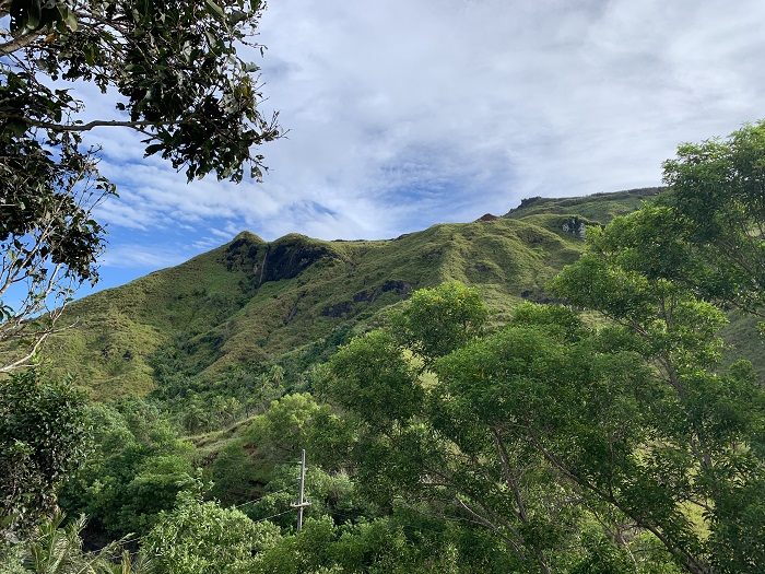
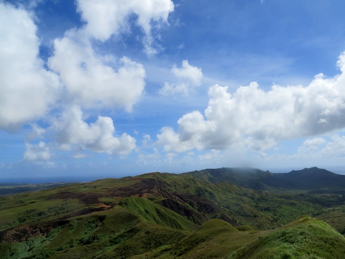
Geologically, Mount Lamlam is part of the Mariana Arc, a chain of volcanic islands and seamounts that stretches across the western Pacific Ocean. The mountain itself is composed primarily of basaltic rock, typical of volcanic islands, with its slopes covered in tropical vegetation that is both lush and diverse, and the mountain’s steep terrain and rocky outcrops are interspersed with patches of dense jungle, providing a habitat for various plant and animal species unique to Guam. The lower slopes are covered with grasslands and savanna-like areas, while the upper regions are characterized by more rugged terrain and thicker forest cover, where this diversity of ecosystems adds to the mountain’s ecological importance and makes it an interesting destination for botanists and wildlife enthusiasts.
While Mount Lamlam is not known for archaeological sites in the conventional sense, it is surrounded by areas rich in Guam’s cultural history. The nearby village of Umatac is one of the oldest in Guam and has several historical landmarks, including the ruins of Spanish fortifications and the site where the explorer Ferdinand Magellan is said to have landed in 1521 during his circumnavigation of the globe. These historical connections add depth to the experience of visiting Mount Lamlam, allowing visitors to connect not only with the island’s natural beauty but also with its long and complex human history.
One of the most mind-blowing facts about Mount Lamlam is its vertical drop from summit to base. Although its peak is only 406 m (1,332 ft) above sea level, the mountain plunges nearly 11,000 m (36,000 ft) to the floor of the Mariana Trench, making it, in this sense, one of the tallest mountains on Earth. This dramatic vertical extent is a testament to the immense forces of nature that have shaped the planet and makes Mount Lamlam a fascinating subject of study for geologists and other scientists interested in the Earth’s structure.
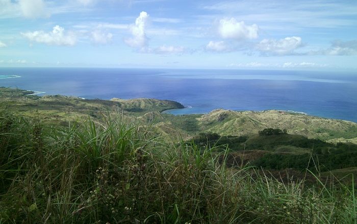
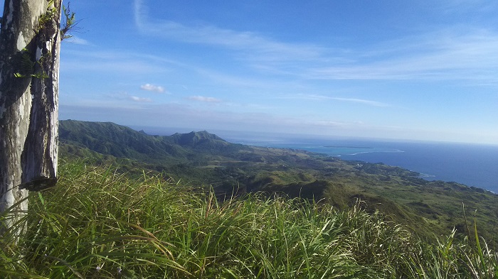
For those that are in this unique US territory and would like to visit Mount Lamlam, it is a relatively straightforward endeavor, though it does require a bit of preparation. The mountain is accessible via a trailhead located near the village of Agat, along Guam’s western coastline, and the hike to the summit is challenging but not overly difficult, making it suitable for most hikers with a moderate level of fitness. The trail is approximately 2.4 km (1.5 mi) long, with a steady ascent that takes about one to two hours to complete, depending on your pace, and along the way, hikers are rewarded with stunning views of the surrounding landscape, including the island’s coastline, dense forests, and the vast expanse of the Pacific Ocean. The trail passes through different ecological zones, allowing hikers to experience the island’s diverse flora and fauna up close.
The best time to hike Mount Lamlam is during the dry season, which runs from January to May, and during this time, the weather is more predictable, as there are clear skies and cooler temperatures that make the hike more enjoyable. Nonetheless, hikers should still come prepared with plenty of water, sun protection, and sturdy footwear, as the trail can be rocky and uneven in places, and the upper reaches of the mountain can also be quite windy, so it’s advisable to bring a light jacket or windbreaker.
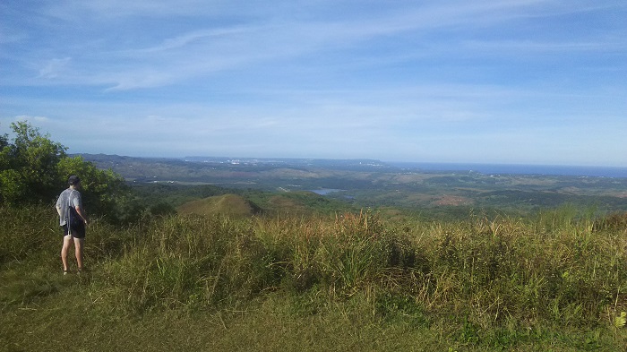
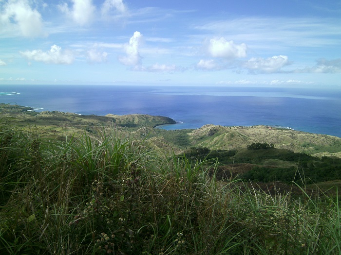
Once at the summit, hikers are rewarded with panoramic views that are truly breathtaking, because on a clear day, one can see the entirety of Guam spread out below, from the island’s lush interior to the azure waters of the Pacific, and in addition to this, the view also includes nearby Cocos Island, as well as the distant outlines of the Northern Mariana Islands. For many visitors, reaching the summit of Mount Lamlam is a spiritual experience, as well as a physical challenge, and the sense of accomplishment is palpable.
For those interested in making the most of their visit, it’s possible to combine a hike up Mount Lamlam with a tour of the surrounding area, because the village of Umatac offers historical sites, while the nearby Agat area has beautiful beaches and snorkeling opportunities. Additionally, guided tours are available for those who prefer a more structured experience, with knowledgeable guides who can provide insights into the mountain’s history, geology, and cultural significance.
All in all, Mount Lamlam with its unique combination of natural beauty, cultural importance, and geological significance, is a destination that offers something for everyone, and whether you’re a hiker, a history buff, or simply someone who appreciates stunning landscapes, a visit to Mount Lamlam provides an unforgettable experience that connects you to the heart and soul of Guam. Its towering presence, both physically and metaphorically, makes it a symbol of the island’s resilience and beauty, standing as a beacon for those who seek adventure and understanding in one of the world’s most remarkable locations.
